Bringing Field Experience into the Preparatory Process for the 2026 UN Water Conference
In March 2026, The Rural Water Supply Network (RWSN) participated in the 43rd UN Water Meeting, held over three days at IFAD headquarters in Rome. As an official UN Water Partner (one of only 39 organizations with that status) RWSN has recognized standing to participate in these intergovernmental preparatory processes, deliver oral interventions, and submit written contributions to official policy documents.
This article explains what RWSN brought to Rome, what happened there, and why it matters for the communities RWSN serves.
Context: RWSN, Skat Foundation, and UN Water
Before turning to the meeting itself, a word on institutional roles.
RWSN is a global knowledge network with more than 17,000 members across 190 countries. It is hosted by Skat Foundation – a St. Gallen-based Swiss NGO that provides the secretariat and staff support that keeps the network running. Valérie Bertschy, Knowledge Management Officer at Skat Foundation, represented RWSN in Rome in her capacity as secretariat staff.
UN Water is the United Nations inter-agency coordination mechanism for all freshwater-related issues, including sanitation. Its Members Meeting are held twice yearly, typically in Rome, and serve as a key preparatory forum for major global water policy processes. RWSN’s status as a UN Water Partner gives it formal access to these meetings – a recognition of its role as a credible, evidence-based voice for rural water across the global governance architecture.
The 43rd Members Meeting was the second major preparatory milestone for the 2026 UN Water Conference, which will only be the third UN Water Conference since 1977. The stakes are high: the conference is expected to produce a framework shaping global water governance well into the post-2030 period.
The Conference Framework: Six Interactive Dialogues
The Abu Dhabi conference will be structured around six Interactive Dialogues (IDs), each with member state co-chairs and UN agency co-convenors. These dialogues formed the backbone of discussions throughout the three days in Rome:
(a) Water for People – co-chaired by Ghana and Switzerland
(b) Water for Prosperity – co-chaired by China and Spain
(c) Water for Planet – co-chaired by Egypt and Japan
(d) Water for Cooperation – co-chaired by Zambia and Finland
(e) Water in Multilateral Processes – co-chaired by Germany and Mexico
(f) Investments for Water – co-chaired by France and South Africa
Participants of the 43rd UN Water Meeting in Rome
What RWSN Brought to Rome
RWSN’s participation was grounded in substantial preparation ahead of the meeting. RWSN produced a gap analysis comparing its Draft Position Paper against each of the six concept paper outlines, and prepared six tailored oral interventions (one per dialogue) designed to introduce rural water priorities into the intergovernmental discussion.
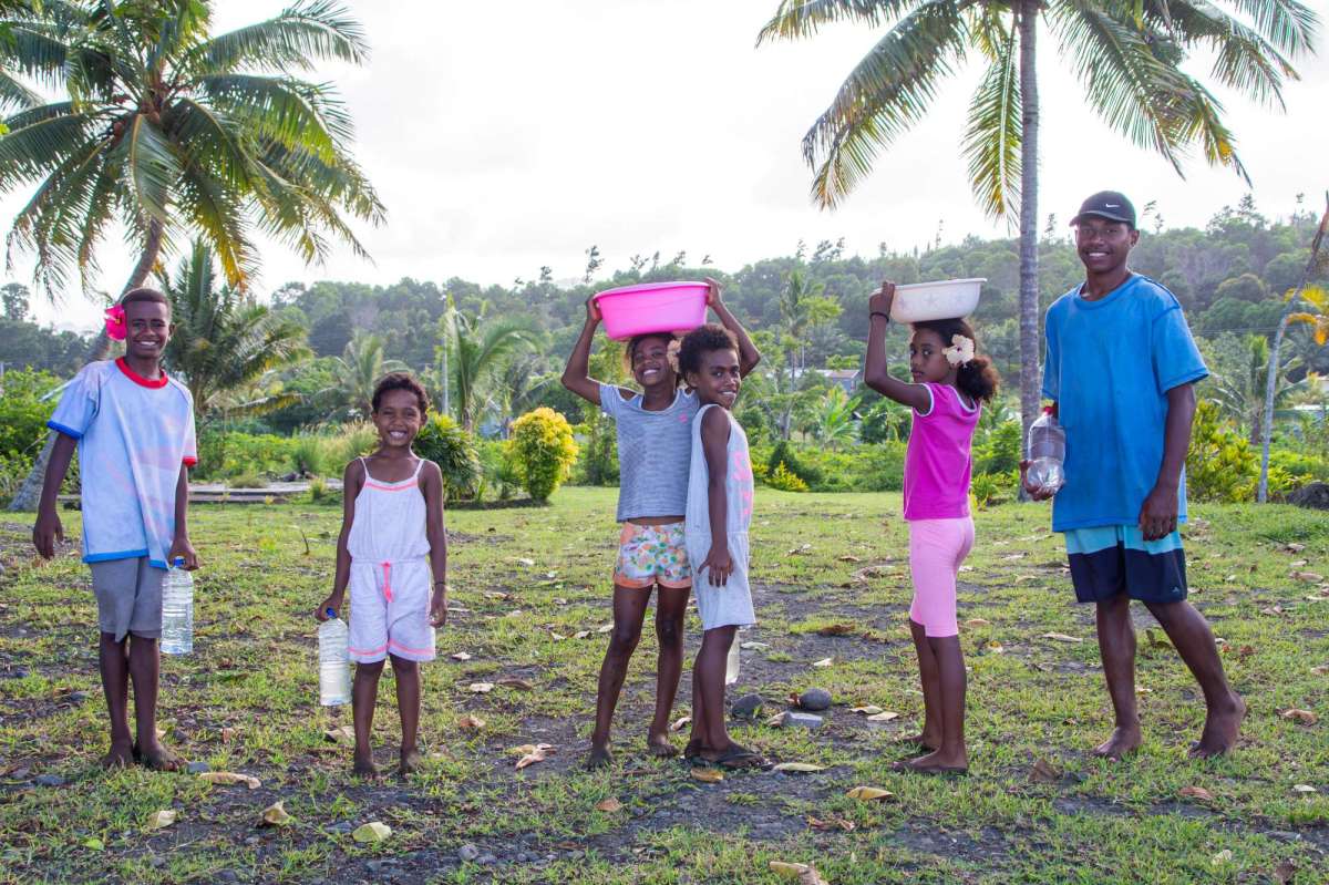
Access to safe and healthy drinking water is a fundamental human right. Yet for many island and rural coastal communities worldwide, this right remains fragile or unattainable. Fiji, an archipelago of more than 300 islands, vividly illustrates this challenge. Despite its tropical climate and abundant rainfall, freshwater resources in Fiji are increasingly under pressure. Over-abstraction, particularly in water-intensive tourism sectors, combined with the accelerating impacts of climate change, threatens the sustainability of water systems. Fiji’s experience reflects a universal struggle for water security in island nations and rural coastal regions.
Island environments are naturally constrained when it comes to freshwater. Unlike continental landmasses, islands have limited rivers, streams, and shallow aquifers. In Fiji, water is sourced from rivers, streams, natural springs, rainwater harvesting systems, and underground aquifers. These sources are highly sensitive to variations in rainfall, land-use changes, and contamination. Once compromised, alternatives are often scarce, making water security a central concern for both rural villages and small island nations.
“Sustaining access to safe and healthy drinking water is not just about scarcity, it is about how water is managed, shared, and protected.”
Over-Abstraction and Tourism Pressures
Over-abstraction has become a critical issue in Fiji. Population growth, urban expansion, and changing lifestyles have steadily increased water demand across the islands. Coastal zones and smaller islands are particularly vulnerable, where shallow freshwater lenses can be quickly depleted. Once over-extracted, these lenses may collapse or become contaminated with saltwater, leaving water unsuitable for consumption.
Tourism, a major pillar of Fiji’s economy, further intensifies pressure on freshwater resources. Hotels, resorts, and other facilities consume large volumes of water for swimming pools, gardens, laundry, and guest services. In many cases, tourist water use exceeds that of local residents. When regulation and conservation measures are weak, tourism can compete directly with community water needs, a challenge common to island destinations worldwide.
Climate Change and Extreme Weather
Climate change magnifies existing water challenges. Rising temperatures increase evaporation, reducing water availability in rivers, reservoirs, and storage tanks. Altered rainfall patterns have caused longer dry periods and more frequent droughts, disproportionately affecting rural and outer-island communities that rely on rainwater harvesting. During extended dry seasons, households often face water rationing or must rely on untreated sources.
Extreme weather events, including cyclones and floods, further threaten water systems. Floodwaters can damage infrastructure, carry debris and pathogens into freshwater sources, and overwhelm natural filtration processes. Sea-level rise also poses a long-term risk for coastal groundwater, as saltwater intrusion contaminates shallow freshwater lenses. Recovery, if possible, may take decades, underscoring the lasting impact of climate change on water security.
Health and Social Implications
Unsafe or unreliable water has serious health consequences. Limited access to clean water increases vulnerability to waterborne diseases, including diarrhea, typhoid, cholera, and skin infections. Children, the elderly, and immunocompromised individuals are particularly at risk. In rural areas with limited infrastructure, households often rely on untreated sources, further increasing health risks and placing additional strain on local healthcare systems.
Inequality in water access compounds the problem. Urban populations generally benefit from centralized treatment and distribution systems, while rural and outer-island communities rely on small, self-managed infrastructure such as rainwater tanks and natural springs. These systems are often outdated, poorly maintained, and highly susceptible to contamination.
Toward Sustainable Solutions
Fiji’s challenges reflect broader patterns among islands and rural coastal regions: limited freshwater resources, competing demands, climate change impacts, and unequal access to infrastructure. Addressing these issues requires integrated, multi-faceted solutions:
Investment in climate-resilient infrastructure to protect storage systems, pipelines, and natural water sources.
Community engagement and local management to ensure maintenance and equitable access.
Promotion of responsible water use across all sectors, particularly tourism.
By implementing these strategies, Fiji can move toward sustainable water management that balances economic development, environmental protection, and public health.
Sustaining access to safe drinking water is more than a development goal, it is a matter of survival, health, and dignity. Over-abstraction, tourism pressures, climate change, and social inequality threaten the long-term resilience of water systems. Protecting freshwater resources, investing in resilient infrastructure, and promoting equitable water management are critical steps not only for Fiji but for island and coastal communities worldwide.
“Ensuring safe drinking water for present and future generations is not only a matter of development, but a commitment to the survival and dignity of island communities everywhere.”
Save our Fiji is dedicated to addressing these pressing water challenges in Fiji and beyond. They work directly with local communities to improve water infrastructure, promote sustainable water management practices, and build resilience to climate-related impacts. By combining research, community engagement, and practical interventions, they aim to ensure that every island and coastal community has reliable access to safe, clean, and sustainable drinking water for generations to come. Save our Fiji joined the RWSN member organisations in April 2024.
Professionalism. Standards. Systems. These themes are repeated throughout Rural Water Supply Network’s (RWSN) spring and fall 2025 webinar series.
Given the large percentage of boreholes with early failure – within one to two years – improvements in standards and professionalism in borehole drilling are necessary. Drilling association leaders spoke passionately about the need for borehole drillers to professionalize to improve the quality of boreholes, increase accountability, stop illegal drilling and enhance community buy-in, which occurs when standards are enforced and certified materials are used.
George k’Ouma, from the Small Scale Drillers Association of Kenya, said it best: Professionalism isn’t optional.
A tidbit: Small borehole drillers have an advantage over large operations because they have knowledge of the local geology and seasonal changes, which enables better planning and materials selection.
Another area in need of increased professionalism is water management. Professor Kwabena Nyarko, from Kwame Nkrumah University of Science and Technology, Kumasi (KNUST), conducted a study comparing public sector, private sector and community water management in Ghana. Model type was less important than having professional standards and following best practices, including metering, tariffs that covered maintenance costs, efficient collection of tariffs, audits and reporting, digital recordkeeping and training, as well as financial support.
Jose Kobashikawa, head of the Enforcement Directorate for Sunass, the regulatory body for drinking water and sanitation services in Peru, echoed these concepts in his presentation. SUNASS uses a benchmarking tool to evaluate rural providers. Metrics include formality and management (are they registered, do they have a water use license), financial sustainability (do they collect tariffs, what percent of customers are defaulters), and quality of services (is water chlorinated and daily hours of water supply). High performing providers are awarded certificates recognizing their good practices in public management and workshops are held in each region to disseminate best practices.
Focusing on systems is another thread that runs through the varied webinar topics. Systems thinking means designing a scheme for the long-term provision of water. Boreholes must be properly sited. Appropriate materials, such as high quality stainless steel (304/316), need to be selected in order to prevent corrosion, as RWSN’s Stop the Rot initiative details. Handpumps often corrode within months or years instead of lasting a decade. Ayebale Ared, Technical and Social Expert at Welthungerhilfe, shared Uganda’s systemic solution: in 2016 the country banned the use of galvanized iron (GI) risers and rods in all new and rehabilitated handpumps – the first sub-Saharan country to do so. Uganda also requires a water quality analysis be done before materials are selected.
In addition, data collection and use must be embedded in all stages and aspects of water projects.. Dr. Callist Tindimugaya, Commissioner for Water Resources Planning and Regulation in Uganda, collects data from drillers which he then turns into groundwater maps the drillers can then use.
Systems thinking also means including the needs of the entire population in the design, especially women, who bear the burden of hauling and carrying water. Women – who are killed by crocodiles while washing clothes in rivers, whose skin is irritated by harsh detergents, who find leaning over low wash basins harder as they age, who need to wash bloody clothes and bedsheets separately from the family’s regular laundry when they menstruate. Laundry is barely mentioned in WASH circles but RWSN devoted an entire webinar to the topic. One speaker questioned how the WASH sector would be different if the metric for success was the amount of time women spend collecting water.
Understanding the local culture is critical; psychologists, behaviorists and sociologists can help provide insights. Technical solutions which aren’t accepted by the community will only lead to failure.
The lack of funds to cover maintenance work on wells is well known. Systems thinking means anticipating root causes of funding issues in a community and pre-emptively building a system that attempts to solve those issues. Tariffs are too low to cover maintenance? Then the project needs to determine how sufficient funds will be raised, whether through higher water fees (that may be less affordable to low-income families) or from external sources. The water committee is inefficient at collecting funds? Then training and capacity building need to be part of the project design from the beginning.
Looking at the bigger picture helps creative ideas flourish: Household rainwater harvesting, replenishing water aquifers through tube recharging, deep bed farming that breaks up the hard pan so water can return to the aquifer, sand dams that filter water and incorporating water management and regreening in the design and construction of roads so crops can grow next to roads. During the laundry webinar, three organizations presented their laundry solutions – devices that save women time, eliminate much of the manual labor, use less water and even offer income-generating opportunities.
The webinars are at times frustrating because we clearly know what needs to be done – yet professionalism, systems thinking and best practices are not always prevalent. More often, though, the webinars are full of insightful information and inspiring stores from experts. The knowledgeable participants, who ask focused, detailed questions, enhance the experience. I look forward to the spring 2026 webinars which are currently being planned.
Rebecca Laes-Kushner is a consultant to NGOs and companies with a social mission, with a particular focus on development issues such as WASH, climate change, supporting SMEs, health care and nutrition. Laes-Kushner Consulting (https://laeskushner.net/) provides research and writing, data analysis, M&E and training services. Rebecca has a Master’s in Public Administration (USA) and a Certificate of Advanced Studies in Development and Cooperation from ETH NADEL in Switzerland.
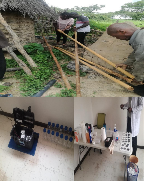
Photo: Supervised Borehole Drilling Project: Collection of Water Samples for Water Quality Analysis at a completed Borehole during the Final Certification Process
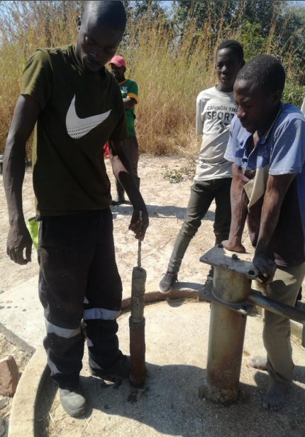
As one of the few remaining qualified, experienced, and active drilling supervisors in Zimbabwe, I would like to share experiences on the status of borehole drilling supervision in my country, Zimbabwe.
Drilling Supervision: A Technical Perspective
Rural areas, where the majority of Zimbabweans reside, are mainly serviced through groundwater sources for their water supply needs. The life span for a significant number of boreholes that have invariably become the technology of choice in Zimbabwe has in most cases proved to be short. This has mainly been due to shortcomings bedeviling the drilling and construction process thereby making the professionalisation of the borehole drilling imperative. Borehole drilling supervision, among other factors, is an integral component of the borehole drilling professionalisation process. This requires the hiring of professionals with relevant qualifications and experience to provide adequate supervision of drilling and related operations for the purposes of controlling the quality of work and securing compliance with the design and technical specifications stipulated for the drilling works as well as generating information for making key decisions in terms of on-site design modifications and the final borehole depth. In this context, questions about whether there is sufficient capacity to supervise borehole drilling in Zimbabwe would need some answers.
Professionals have left the country
Most of the qualified hydrogeologists or professionals with a geological background and relevant experience in drilling supervision have migrated to other countries in the Southern Africa region and beyond. This has largely been due to the fact that job opportunities in the groundwater development field in Zimbabwe are scarce.
BushProof Sàrl, mettant à profit une expérience de travail de plus de 15 ans dans le Sud de Madagascar, appuyé par deux hydrogéologues de la Direction du Développement et de la Coopération (DDC), s’est proposé de travailler de manière appropriée sur la connaissance des aquifères des régions du Sud de Madagascar. Ensembles, ils ont financé et créer un outil cartographique afin d’améliorer la connaissance du fonctionnement des eaux souterraines dans le Sud de Madagascar. Cet outil a été réalisé en 2023.
Le Sud de l’île de Madagascar connait, depuis plusieurs années, des périodes prolongées de sécheresse. Les populations locales grandissantes y ont aujourd’hui un accès très restreint à l’eau, ce qui engendre des conditions de vie dégradées. Pourtant, d’importantes d’eau transitent dans cette zone via des aquifères dont le fonctionnement reste mal connu.
BushProof Sàrl, drawing on more than 15 years’ experience of working in southern Madagascar, supported by two hydrogeologists from the Swiss Agency for Development and Cooperation (SDC), set out to work in an appropriate way on knowledge of aquifers in the regions of southern Madagascar. Together, they financed and created a mapping tool to improve knowledge of the functioning of groundwater in southern Madagascar, which was completed in 2023.
The south of the island of Madagascar has been experiencing prolonged periods of drought for several years. The growing local populations there now have very limited access to water, leading to deteriorating living conditions. However, large quantities of water flow through this area via aquifers whose functioning remains poorly understood.
This blog is part of a four-part series covering the presentations given at the 11th Zambia Water Forum and Exhibition. The event, themed “Accelerating Water Security and Sanitation Investments in Zambia: Towards Agenda 2023 through the Zambia Water Investment Programme”, lasted three days.
Our blog series takes a focused look at the presentations and discussions that revolved around “Addressing Rapid Hand Pump Corrosion in Zambia – Stop the Rot!”, which was co-convened by UNICEF and WaterAid, together with Ask for Water GmbH and the RWSN, hosted by Skat Foundation.
Cover photo: Red, iron-rich water being pumped. Photo: WaterAid Uganda
Second session:
The role of galvanized pipes in the corrosion and failure of hand pumps
Empowered Communities Helping Others (ECHO) has been implementing a safe water project since 2020. This is a Water Sanitation and Hygiene (WASH) project, whose main intervention is borehole rehabilitation which is implemented in rural parts of Zambia’s Western and Central Provinces, in collaboration with the Local Authority. In practice, the need to rehabilitate a borehole arises when a functioning borehole presents usage problems such as non-production of water, worn out parts such as pipes, rods, handles, chains, cylinders, water chambers, pedestal, head assembly, bearings, etc.
Since 2020, ECHO has rehabilitated a total of about 850 boreholes in Central and Western Zambia, benefiting a total of about 255,000 people.
It was found that rehabilitating a borehole can be more economical than constructing a new one. It is simpler and faster and can be an appropriate solution in an emergency because it doesn’t require things like mobilizing a drilling rig. However, if the rehabilitated borehole is to be used for a long time, it is important to estimate its life expectancy.
The rehabilitation option chosen depends on the conditions of the existing borehole, the causes of the damage, the technical and logistic options, and the existing alternatives such as the construction of a new water point.
According to the severity of the borehole problems, the work requirements may vary from a simple repair at the surface to re-equipment.
For the project, all GI pipes are replaced with new PVC ones. This is done in order to prevent and reduce iron contamination (as a result of corrosion) which from the past four years we have observed is a contributing factor to borehole failure and abandonment
The main observed sources of iron are:
▪ From natural sources in the aquifer
▪ From pump components such as steel casings and galvanized pipes.
▪ In other instances, a combination of both has been observed to be possible. ▪ Within 3 to 6 months of installing hand pumps with galvanized material, pipes and rods have been found to be heavily corroded.
▪ When corrosion is the main source of iron, iron concentrations reduce drastically when water is pumped out and fresh recharge is allowed. If iron concentrations remain high throughout during continued pumping, the case has been that it is likely the iron is coming from the aquifer.
Experiences on hand pump corrosion
Hand pumps with GI pipes, sometimes only a year or two old have corroded, and people have returned to unprotected water sources. Water with pH below 6 has been observed to have corroded pipes. High iron concentrations in handpumps have been a usual occurrence this has been observed through regular water quality testing and evaluating the change in iron concentration over the period of our operations. Stainless steel pipes and rods had corrosion rates lower than galvanized iron (GI) pipes and rods.
Experiences on hand pump corrosion
The brown or reddish color is observed in the morning when the pumps had not been used during the night
However, groundwater has been observed to hold significant concentrations of iron but appears clear and colorless. When this water is pumped out after being exposed to the atmosphere, the color changes to red/brown.
Figure 3: Sampled on Friday 2nd June 2023 in Central Province.
General complaints recorded from communities:
Within weeks and months of installation, communities would begin to complain about water quality. These complaints range from metallic taste, odor, and the appearance of water. Also, the communities would report discoloration of water and cloths and highly turbid water.
All these result in people abandoning the water point and going back to unprotected alternative water sources.
Positive observations
The use of uPVC pipes and stainless-steel adapters has so far shown positive results in reducing iron contamination. After switching from galvanized pipes to UPVC, the communities have observed reduced to no brown or reddish color in the water. uPVC pipes last long, so you won’t have to worry about replacing them anytime soon. Since uPVC is non-porous, uPVC pipes help by preventing any contamination from occurring. uPVC is resistant to corrosion as it is not susceptible to chemical and electrochemical reactions, so there are better option in controlling iron contamination. The use of uPVC pipes and stainless-steel adapters has so far shown positive results in reducing iron contamination
Figure 4: Riser pipe removal and water quality testing for an installation that was less than six months old by ECHO.
What we are advocating for:
▪ Stakeholders should address the handpumps with corrosion problems as a priority in order to guarantee the water quality we supply to the people.
▪ Testing boreholes that present iron contamination to determine whether the source of iron is from the aquifer or from corrosion. This will provide the best options for the right material to equip the water point with
▪ Competent borehole drilling and rehabilitation supervision should be ensured so that all standards and specifications are adhered to.
▪ Regular water quality analysis is undertaken, and critical parameters are tested to address problems such as corrosion and other related problems that shorten the life span of a hand pump
You are invited to access the presentations HERE, along with the session’s concept and report. If you would like to dive deeper into the enriching exploration of water challenges and solutions through the Stop the Rot initiative, visit this page.
About the author:
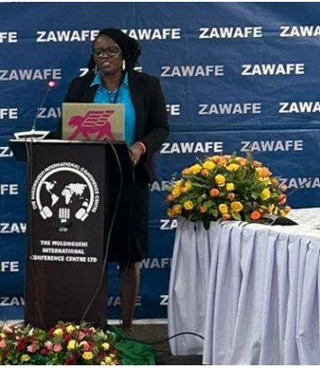
Annie Kalusa – Kapambwe presenting at at ZAWAFE 2023
Annie Kalusa is an accomplished development practitioner and administrator. Currently working for a local Zambian NGO Empowered Communities Helping Others (ECHO) in Zambia, focusing on improving the wellbeing of Vulnerable Rural Communities. Her areas of focus are climate resilient Water Sanitation and Hygiene (WASH). She is currently developing her thesis on Rural Agriculture Practices and Mechanisms for Water Resource Management.
Professional Drilling Management & Groundwater Resources Management
Thanks to funding from the Federal Institute for Geosciences and Natural Resources (BGR) in Germany, 2022 saw Ask for Water GmbH, together with the Africa Groundwater Network, Cap-Net UNDP and several other partners (see below) develop and run two online courses on groundwater. The courses strengthened the capacity of staff of governments, NGOs, the private sector and academia in African member states and beyond.
The courses, hosted by Cap-Net UNDP, and offered free of charge to participants, were entitled Groundwater Resources Management and Professional Drilling Management. Each course was specifically developed for professionals working on these issues, or responsible for decision making.
Face to face training course on drilling supervision in Sierra Leone (Source: Kerstin Danert)
Professional Drilling Management Course
Drilled water wells are vital to achieving universal clean drinking water, providing safe, affordable, reliable and available water sources. To ensure that the water wells or boreholes are built to last, they must be drilled, developed and completed in a professional manner. Key elements of a professional drilling sector are robust procurement, contract management, siting, borehole design, construction, and supervision. Furthermore, the management of the groundwater resources must also be considered and support provided to long-term maintenance if services are to last. Unfortunately, in many countries it is difficult to develop skills in these areas due to a lack of training and mentoring opportunities.
The 2022 online course on Professional Drilling Management provided participants with a comprehensive overview of the different aspects of drilling management, specifically (i) groundwater data and siting; (ii) procurement and contract management (including costing and pricing; (iii) borehole drilling and supervision and (iv) legal and institutional frameworks. In the last of five modules, participants were encouraged to reflect upon and share actions that they as individuals and as organisations could take to raise drilling professionalism in the context in which they work. From the 781 people who applied for the course, 314 were selected, of which 209 were active participants. A total of 162, equivalent to 78% of the active participants passed the course.
You can access the 2022 course report, manual and key training materials here.
If you would like to learn about what alumni of previous online courses on Professional Drilling Management have done with their knowledge, check out the short film below or the short report of their testimonials.
Groundwater Resources Management Course
An estimated 50% of the global and 75% of the African population rely on groundwater for their drinking water supplies. Groundwater supports social and economic development and will become increasingly important in the face of climate change, as groundwater resources are often less affected than surface water by climate change impacts. If groundwater is to provide reliable, safe and sustainable water supplies now and for future generations, the resource must be well-managed. This requires consideration of the entire system of policies & laws, strategies & guidance, monitoring & management as well as investments & projects. Good groundwater management needs sound capacities in water authorities. But at same time, as many elements of groundwater management fall in other sectors, a general understanding of groundwater management principles in sectors like agriculture and urban planning is key for its successful implementation.
The 2022 online course on groundwater resources management provides participants with a comprehensive overview of the multiple factors that impact upon groundwater. It was a self-paced course and was hosted on the virtual campus of Cap Net/UNDP.
The course comprised 5 modules; each with a short introduction, goal, learning objectives and orientation video, as well as mandatory videos and reading materials:
Module 1: Characterization of Aquifer Systems from a Management Perspective
Module 2: Groundwater monitoring and data/information management & communication
Module 3: Groundwater quality and source water protection
Module 4: Groundwater regulation, licensing, allocation and institutions for aquifer management
Module 5: Transboundary aquifers in Africa: Approaches and mechanisms
You can access the 2022 course report, manual and key training materials here.
Artesian well near Lake Chad, Chad (Source: Moustapha Diene
What next?
The Rural Water Supply Network (RWSN), Ask for Water GmbH, the Africa Groundwater Network (AGW-Net), Cap-Net UNDP and partners would like to offer these courses on an annual basis. We are currently looking for sponsors/funders to make this possible. In case you are interested, please contact us via info@rural-water-supply.net.
Covid-19 gave me the chance to commit to paper (or electronic form, if you prefer) some of my understanding and experience gained over several decades. The outcome is a book, published earlier this year, entitled Rural Community Water Supply: Sustainable Services for All.
Richard encountering some resistance in Kaabong, Uganda (photo. RC Carter)
Many hundreds of millions of rural people – the exact number is not known, and it is immaterial, except that it probably lies between one and two billion – experience inadequacies in the supply of the water which they use for drinking and other domestic uses.
These inadequacies are partly reflected in the ‘normative criteria’ as defined by the human right to water which apply to water services globally. These criteria ask whether and to what extent water services are available, accessible, affordable and acceptable, and whether their quality meets national or international standards. They also highlight the importance of cross-cutting criteria (non-discrimination, participation, accountability, impact, and sustainability).
Premature corrosion and failure of water supply hardware, particularly handpumps, is widespread in countries within Sub-Saharan Africa, but evidence is limited and largely anecdotal. If drillers are not assured of quality handpumps in country, how can they install pumps that provide water users with the services that they deserve? For the tens of millions of people in sub-Saharan Africa who depend on handpumps to meet their daily water needs, handpump failures threaten their health and livelihoods.
In cases where communities receive a handpump or components of substandard quality, parts may rapidly wear. If components of the wrong material or inadequate quality are installed in aggressive groundwater, the water supply may not function properly or can fail. Alternatively, the water may not be suitable for drinking. If the handpumps fails, or if water is turbid, discoloured, or has a metallic taste, users may return to using distant or unsafe water sources. If handpump components wear prematurely, communities can incur unnecessary costs in trying to fix the problem.
A new initiative by Skat Foundation and Ask for Water GmbH under the Rural Water Supply Network (RWSN) strives to find ways to ensure that handpump technologies and spare parts that are installed for drinking water in sub-Saharan Africa are consistently of high quality and can last.
The initiative runs up to March 2022 and will:
Document the scale and extent of the problem of handpump corrosion and poor-quality components in sub-Saharan Africa.
Understand the handpump supply chains for one country, analysing strengths and weaknesses.
Raise awareness of problems of handpump corrosion, poor-quality components alongside practical solutions for water users, drillers, governments, Non-Governmental Organisations (NGOs) and others.
Catalyse action through ongoing engagement of international organisations, national governments, research organisations and other stakeholders to catalyse actions to tackle the problem.
The initiative will examine corrosion (see box), quality assurance procedures and supply chains. It seeks to draw out successful or innovative ways of ensuring that users benefit good quality handpumps – consistently! If you would like to contribute to the initiative, especially by sharing your experiences and ideas, please contact Dr Kerstin Danert (ask @ ask-for-water.ch).
Box: Corrosion and handpump quality challenges
The twin challenges of how to ensure the quality of handpumps and how to prevent rapid corrosion of certain pump components have been discussed for over four decades. Corrosion of below-ground handpump components was documented in the 1980s. Research concluded that galvanisation of pump riser pipes and pump rods does not prevent corrosion where the pH < 6.5 and provides limited protection for pH 6.5 to 7. In light of this, programmes have switched riser pipes and pump rods to stainless steel or switched to uPVC riser pipes and stainless-steel pump rods, while some countries standardised on pumps which aims to be fully corrosion resistant by using a uPVC rising main and stainless steel, or fibre glass pump rods. Unfortunately, handpump corrosion problems and concerns over handpump component quality persist. The extent of the problem is not fully known because of relatively little research on this topic, coupled with a lack of information available in the public domain.